By email to: pabc@broxtowe.gov.uk
Subject: Planning Application 25/00925/OUT
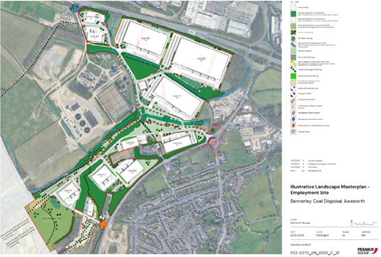
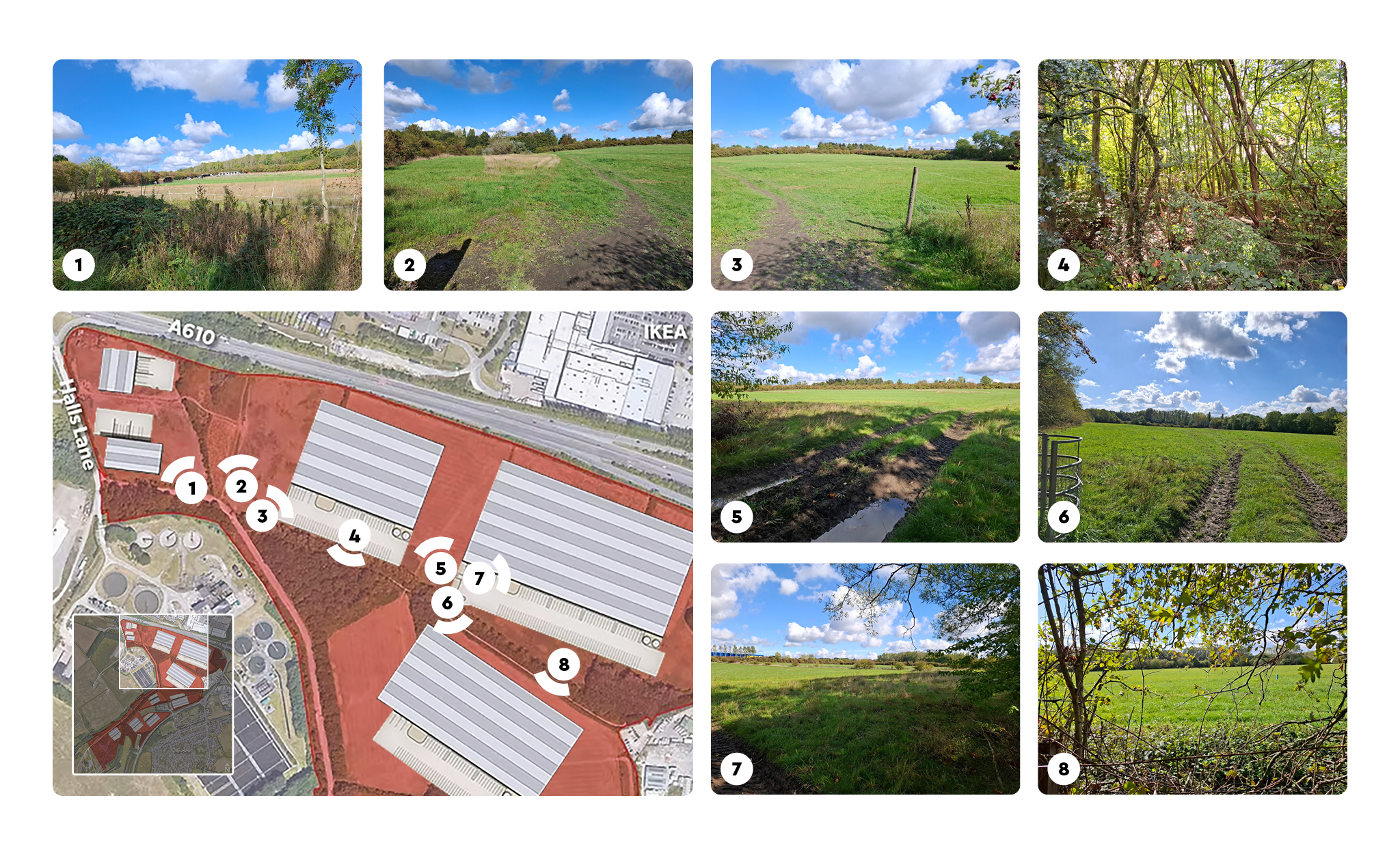
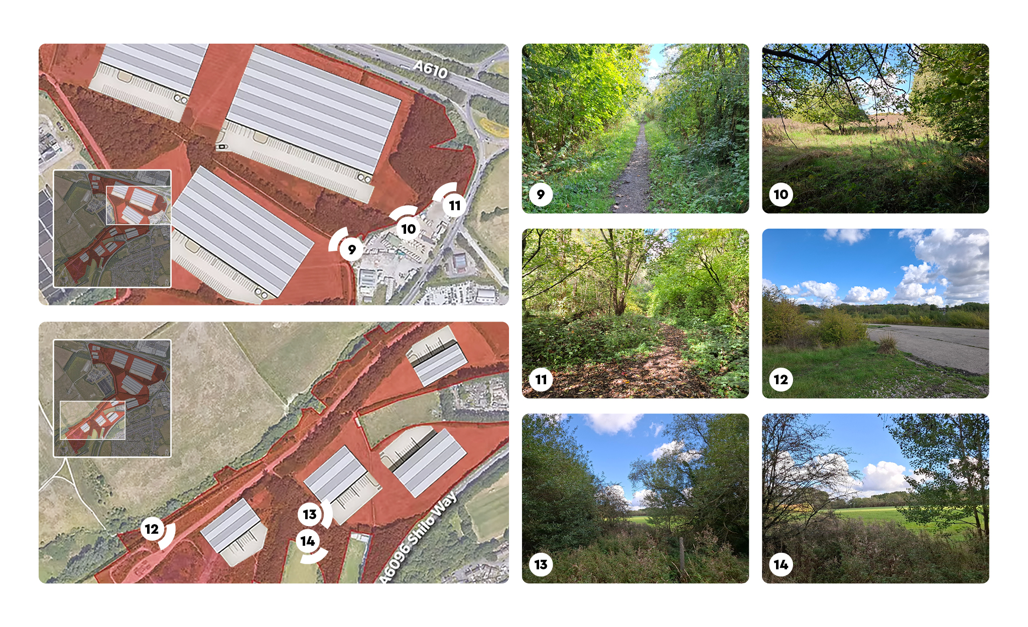
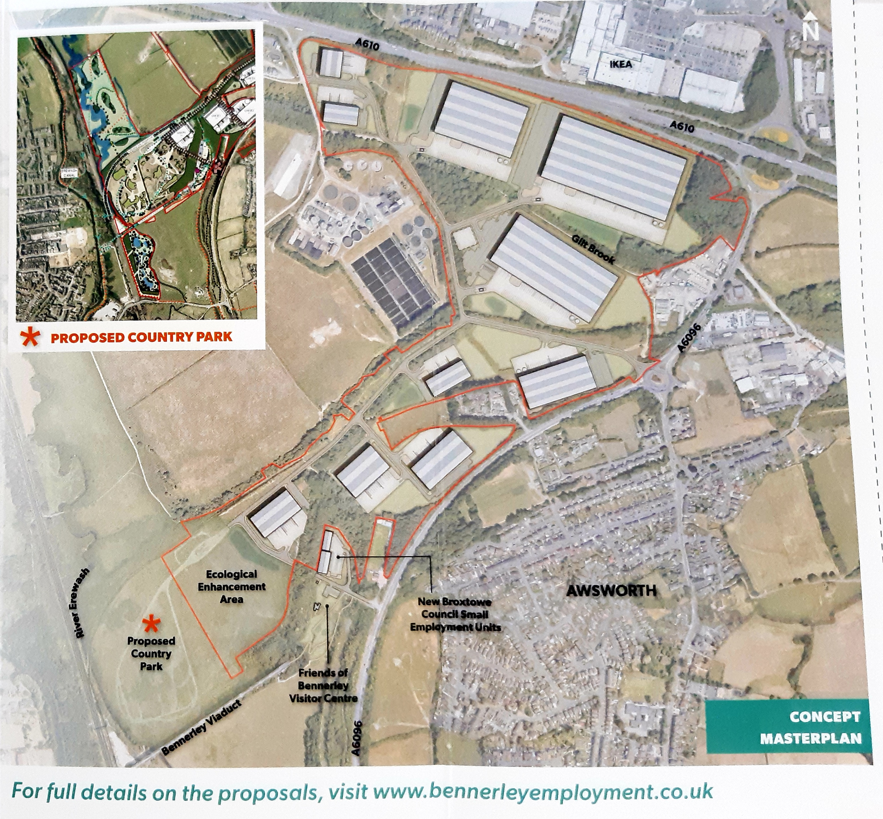
Outline Planning Application for the construction of up to 130,000 m2 (1.4m sq.ft) of B8, B2 and E(g)(iii) Use Class units, including site access and infrastructure, with all matters reserved apart from the details of vehicular access from Shilo Way and the A610.
Land To The North Of Bennerley Viaduct Newtons Lane
Attention: Planning Department, Broxtowe Borough Council
Dear Planning Officer
I wish to formally object to the above application on the grounds set out below.
Destruction of the Green Belt
The National Planning Policy Framework (NPPF 2024, paragraph 153) clearly states that when considering any planning application, substantial weight is given to any harm to the Green Belt and should not be approved except in very special circumstances.
The site plays a vital role in preventing sprawl and preventing settlement coalescence. The proposed density is too high for a rural setting. This development would cause significant and demonstrable harm to the Green Belt. The very special circumstances have not been identified.
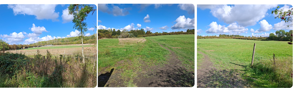
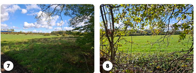
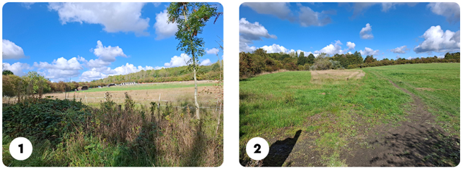
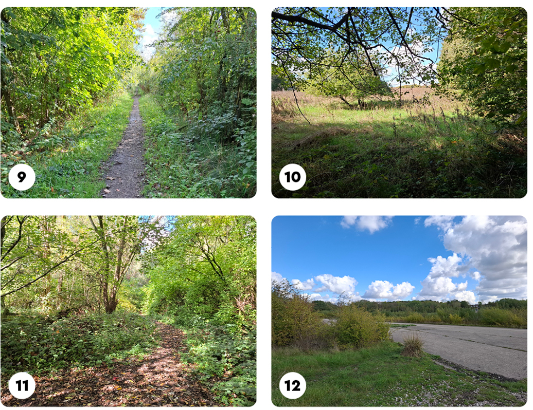
Harm to the Environmental and Biodiversity
The site supports an abundance of red list protected species including great crested newts, water vole, otter, bats, lapwing (as well as many other waders during the winter months), martins, swifts, kestrels, kingfisher, and forms an important ecological site. 4855 protected, priority and notable species were recorded on this site. As well as destruction a Green Belt, almost 1 km of hedgerow and almost 1 hectare of open mosaic habitat will be destroyed as a result. Building on this nature-rich landscape will destroy precious habitat and adversely impact biodiversity despite attempts at BNG.
Highways, Traffic and Pedestrian Safety
Traffic generated by the development would severely impact local roads which are congested, compromising safety and traffic flow. Proposed access points will increase the already high volume of traffic. Traffic pressures are already expected to increase due to the Bennerley View estate and 200 acre Stanton Park site.
Unsustainable Location and Car Dependency
Buses in this area are infrequent and unreliable, The plan is intended to create 2,626 full-time equivalent jobs, which will equate to approximately 3,000 extra cars using our already congested roads. The inclusion of car parking bays in the plan supports this reliance on cars. The application promotes car dependency, contrary to national planning guidance and emerging Local Plan policies promoting sustainable transport.
Drainage and Flooding Concerns
The site currently drains into areas already known to be at risk of flooding, which would be exacerbated by increased hard surfaces from the development. Any unresolved drainage and flood risk concerns would increase the risk of flooding to communities downstream.
Prematurity and Conflict with Strategic Planning
The suitability of this site has not been inspected by the Secretary of State. The application is premature and should be put on hold until approval is confirmed in 18 months’ time. Approval of this application would be premature and would undermine Broxtowe’s plan-led system.
Furthermore, this site was selected by Broxtowe because of its proximity to a railway line. This development fails to make use of the railway and therefore negates the need for this development to be situated here.
Bennerley Viaduct
Significant effort and public money has been invested in preserving the Grade II listed Viaduct as a heritage attraction. This development will severely impact the landscape around it.
No guarantee of jobs to local people
There will be no guarantee that any jobs created at this site will be for local people.
For these reasons, I urge Broxtowe Borough Council to refuse Planning Application 25/00925/OUT.
Thank you.
Name: ____________________________________
Full address: ________________________________________________________